Posts

DoakBurn (Again)

Image
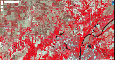
 Introduction The goal of this lab was to use ArcGIS Pro to view the various band stacks of orthomosaic imagery and a normalized difference vegetation index (NIVD). The data was collected by Dr.Hupy, William Weldon and Zack Miller, and the data was of a controlled burn with multispectral cameras. Methods The methods of this lab was to look at the areas that were burned and compare them to the areas around them that were not burned. This could be done with RGB, or band stacking for the imagery, which allows the ability to see things that are not able to be seen with the human eye.  Metadata from the Flight Vehicle: Bramor PPX Sensor: Altum Flight Number: 2 Takeoff Time: 12:18 Pm Landing Time: 12:35 Pm Altitude (m): 121 Sensor Angle: NADIR Results  The data collected with the band stacking shows the differences between the pre-burn and post-burn data. Figure 1,2,4,5,6,9 are in a 5,3,2 band stack, meaning the red represents near-infrared, the green represents th...

ERSI Landsat Blog

Image
Introduction  ERSI Landsat is a tool in which one can look at various parts of the world using satellite imagery. Although the data in landsat does not have as high of a pictorial resolution, it is much easier to view the imager in a broader context. We looked at multiple different settings and portions of the light spectrum to gain insight into different parts of the world.  Methods For the first image area surveyed, it was the farmland around Purdue, in the infrared color spectrum. This was used to capture images to understand where the healthy vegetation was located in the area. The light spectrum used the 700 nm - 1mm portion of the EMA band. The brighter the red in the images, the healthier the vegetation.  Figure 1. Infrared Satellite imagery around Purdue University Next, we viewed satellite data as an index. This allowed different moisture indexes to be seen and look at areas that would be good for farming and have more moisture.  Figure 2. Door County, WI, V...

AT 309: ArcGis Earth Intro

Image
 Intro ArcGIS Earth is a software that can be used to analyze, visualize, and evaluate data in a geospatial location. It can do many diffrent things from looking at the terrain in locations to comparing data collected from uas to satellites and many other sources of data.  Remote sensing can use ArcGis earth for many diffrent tasks, such as analyzing a flight location or comparing data. For looking at flight locations ArcGIS Earth has diffrent features to help determine if the pilot will be able to keep the UAV they are operating within line of sight, and other terrain-based information. When analyzing data the ability to compare the data collected with many available sets allows for cross-checking the information.  Methods Preflight Figure 1 shows the terrain data from a flight line in West Lafayette. This can be beneficial for seeing how the terrain in a specific flight path changes, as that could cause the aircraft to hit the terrain in a pre-programmed mission or wors...

AT 309: Lab 2, The Digital Transformation

 Introduction      Big Data, Cloud computing, Internet of things (IoT), and Artificial Intelligence (AI) are all the buzz words of this past decade, but what do they really mean and how will they impact uas usage. Uas is related to all of the different aspects of the information age, as the goal of many commercial uas missions is to collect information.       The digital transformation drives uas development through the creation of different uas and parts for uas. Big data drives the development of uas that are able to carry different sensor platforms to collect various types of data. Cloud computing is driving the development of diffrent technologies like unmanned traffic management (UTM). IoT is also allowing for uas to begin to communicate with each other to allow for UTM. AI is now driving the development of uas that are able to use visual navigation for beyond visual line of sight operations (BVLOS). The digital transformation is also driven ...

AT 309: Introduction to Blogger

 Introduction  I am Nicholas Hansen, a junior majoring in unmanned aerial systems and minoring in design and aviation. I am a teaching assistant for Dr. Damon Lercel and William Weldon, and assisting in the AT 109, UAS design and construction and AT 209, Civilian UAS, Classes currently, and I have also assisted in AT 119, UAS inspection and repair, in the past. I am also Vice president for the Purdue Drone Club. I operate for Purdue’s Agricultural Research Center, flying DJI M600s and M200s with RGB, Hyperspectral and LiDAR sensors. I have been flying drones since 2010, the first drone that I flew was a Parott AR drone, and since 2012 I have been building and developing many different platforms, fixed wing, multirotor and VTOL.  For this class AT 309, introduction to uas sensors, I was required to create a blog where I will post my lab reports much like my previous courses. To begin this blog we started by looking at others blogs and seeing what worked and what did n...

Literary review 2

While writing the paper on Neural Networks and drones, I learned a lot about the writing process of a literature review paper. Many of the things that I learned can be applied to different literature review papers as well as general papers. Data Collection I found it very helpful to begin by collecting as many articles as I could on neural networks and drones. I did this by using the schools data bases and google scholar. To help aid me in finding as many different papers as possible I developed a list of key words to search for. The list of them for the vehicle part were, Drones, UAV, UAS, SUAS, unmanned systems, aircraft, helicopter, multi rotor. These helped narrow the search down to the type of application I wanted to see neural networks in. Neural networks also had a list of key words that allowed me to gain a few more articles, those keywords were, Neural network, Artificial intelligence, deep learning, machine learning. Those all corresponded to what type of research I wanted...

Literary review 1 while writing on neural networks and drones

Image
While writing a paper on the uses of neural networks and drones I learned a lot about the advantages and disadvantages of them. These allow for a better understanding of when it is appropriate to use one with a drone and when it is ineffective to use one. Advantages The main advantages with using a neural network come from using a vision based system to aid the drone in operation. The vision system can be used for tracking people, perfecting landings, and even counting cows. The benefits of using a neural network is that it can reduce the complexity of operations, or it can improve the efficiency of the operations. These are the main functions for any additional software for drones, and a neural network is a much more specific software. In applications like counting cows, the neural network is ground based, and is just processing on a computer to analyze the data post flight. It does this through image filtering, figure 1, and that allows the computer to count the number of cows. Th...